No, not every single, 'big' pipeline passes through Native American lands. There are a lot of pipelines and they are arranged in a huge network, some terminating at both ends having never passed through Native American lands.
First, the claim is a bit weaselly. What is a 'big' pipeline? They don't define it. The US Department of Transportation (DOT) tracks all interstate pipelines and gathering lines. They don't manage intrastate lines, so I cannot speak on that. But since this claim is probably in reference the Keystone XL, we'll assume interstate pipelines. There are many factors that go into which pipelines the DOT tracks but generally it is 6" and up in size for low pressure systems.
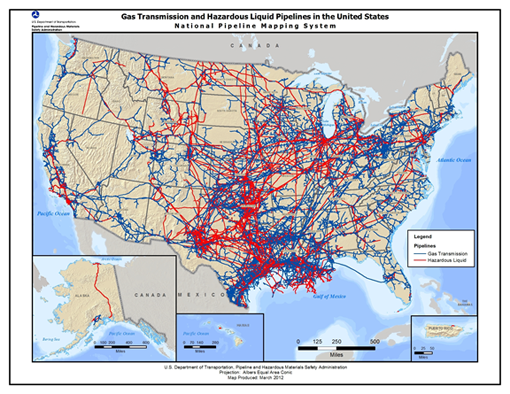
As a local government official, I do have access to the USDOT GIS data of all 'major' hazard liquid and gas pipelines. Unfortunately, that GIS data is tied specifically to my person and there are explicit rules about how I use that data (for security reasons). I am a bit fuzzy on their position on sharing images, so would I feel uncomfortable sharing a US map of the pipelines. One way to describe what it looks like is a network of pipelines, not just a few spread around the US. A map of state highways and interstates is about the density of pipelines throughout most of the US.
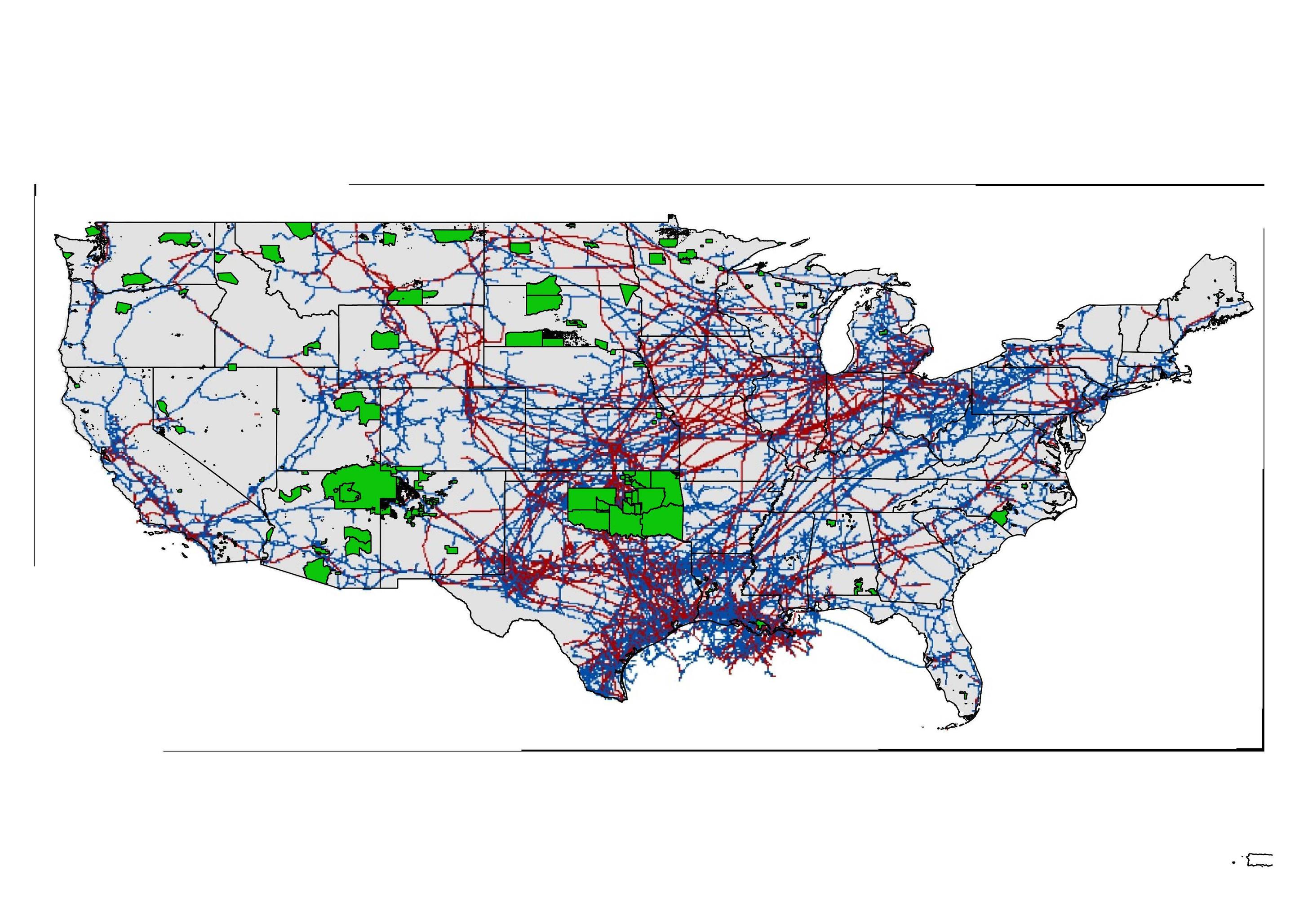
As you can see from the image, there are a lot of 'big' pipelines that do not even pass through Native American Lands. Hard to see in this photo, but some lines make an effort to avoid passing through the Crow Reservation in southern Montana; no idea if this was due to protests, risk assessments, or avoid litigation.
Pipelines in the US with Native American Federal Lands superimposed.

You can view maps of pipelines by-county here:
https://www.npms.phmsa.dot.gov/PublicViewer/
In finding the definition of what lines the DOT tracks, the map on the front cover of this PDF is very close to the data I have.
https://www.npms.phmsa.dot.gov/Documents/Operator_Standards.pdf


