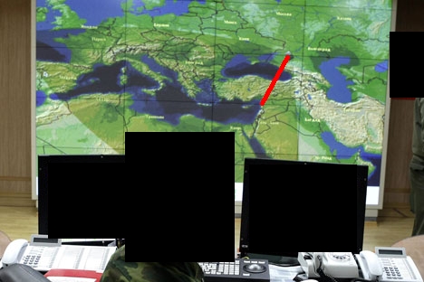
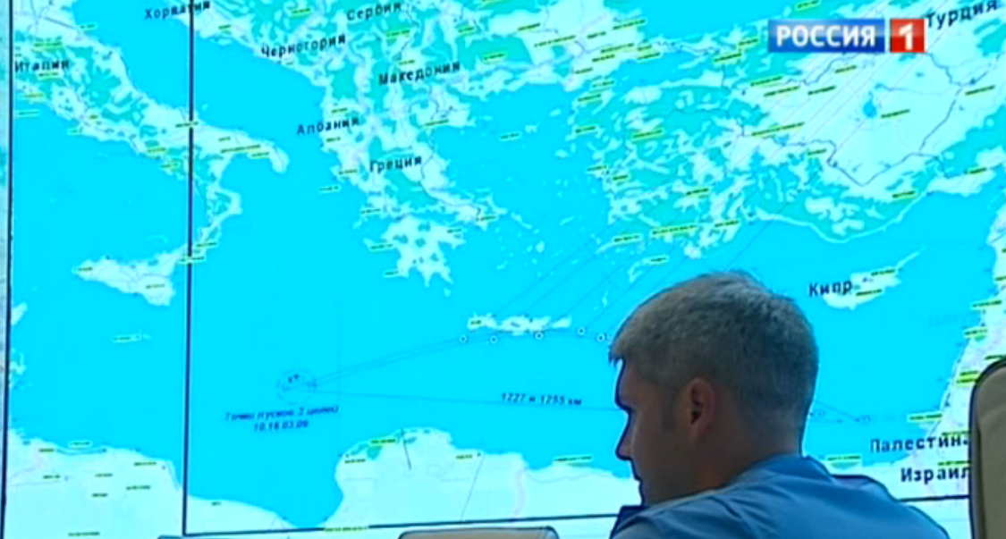
Some time ago there were several statements about missile launch detection over the Midterranean using russian Station Armavir:
Armavir radar station’s quick detection of the launch of two ballistic missiles near the Syrian coast success for Russia’s missile defense system. A radar station Voronezh-DM located at Armavir covers more than 3,7 miles , including the entire Black Sea and Mediterranean. A radar station located at Armavir tracked the launch of two missiles that dropped into the sea. the launch was a joint Israeli-U.S. missile experiment. the Armavir radar station that detected the ballistic launch performed in accordance with its specifications: Its coverage extends to 6,000 kilometers (3,728 miles), including the entire Black Sea and Mediterranean.
The launches took place at 10:16 am Moscow time (0616 GMT) and were detected by the ballistic missile early warning system in Armavir in southern Russia, the defence ministry said
There is already question about that here: Were two ballistic missiles fired from Spain towards Syria?
But in my question I want focus on geometry and radio wave propagation through atmosphere.
We can check that there are two types of radars (check page 10 of the Navy's PDF): above the horizon and beyond the horizon (OTH). First type uses straight lines from radar to the target and OTH uses "HF or 'High Frequency' range is the part of the electromagnetic spectrum between 3MHz and 30MHz." which is mirrored by some layers of atmosphere and radio wave propagate as polygonal chain (piecewise line). First type is limited by line-of-sight and second is not.
Voronezh-DM is declared as first type of radar and it uses straight line because of frequency of 0.1m (UHF) - which is between 300 MHz and 3 GHz and not in range of 3 and 30 MHz.
Armavir is located at distance of at least 700 miles (1100 km) from nearest point of Syria (I checked for Latakia, using data from 1):

So the question is to imagine how high should fly the "test ballistic missile" above Mediterranean (Cyprus, Latakia) to be visible for the above the horizon radar in Armavir.
There are some formulas here: http://www.navymars.org/national/training/nmo_courses/nmoc/module18/14190_ch1.pdf page 10, but I can't apply them correctly. Also I'm not sure that the World Goverment and their The Army allows Internet everyman to know true formulas for long-distance radar horizon computation. I believe there is some refraction in the air at high altitude for 0.1 m UHF radio waves.
As I think, the something what was called the "test ballistic missile" was not the classic ballistic missile which can be used by Syria or Iran (Scud of 300-500 km range). Instead, it was the real outer space rocket with maximum altitude greater then 100 km, or kind of anti-satellite missile (capable of destroying of ISS space station).
Update: somebody in linked question says about Sparrow missile http://en.wikipedia.org/wiki/Sparrow_(target_missile) http://www.rafael.co.il/marketing/SIP_STORAGE/FILES/2/622.pdf
The missile is currently used as a target missile to test the Arrow anti-ballistic missile system.
the Silver Sparrow version is designed to simulate Iranian Shihab-3 class ballistic missiles with a 1,500-2,000 km range.
The Silver Sparrow version was first tested on September 2, 2013.[7] The launch from the Mediterranean was detected by a Russian ballistic missile early warning radar at Armavir,[8][9]
Can somebody recompute 2000 km range to the maximum altitude?
Thanks to http://vif2ne.ru/nvk/forum/0/archive/2514/2514114.htm

Full videos:
